

The only company to deliver mount mapping report of sample tower in less than 24 hours
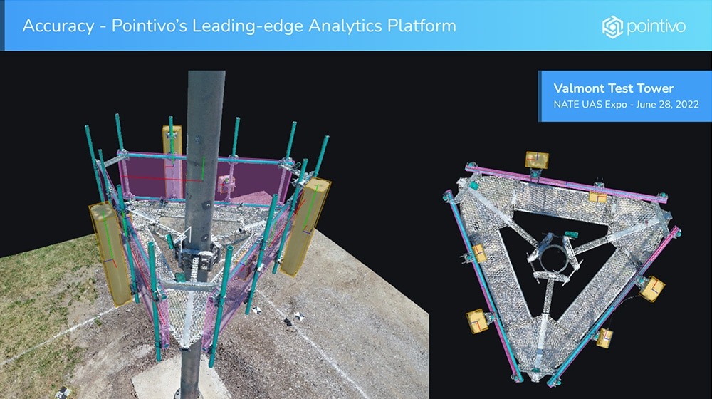
The NATE UAS event, hosted at Valmont in Valley Nebraska, was held to assess the progress of drone captured data and analytics in the telecommunications infrastructure industry. Eight different companies demonstrated their drone inspection capabilities. Pointivo flew the tower, and not only produced a precise digital twin, but completed a full and accurate mount mapping report of the demo tower in less than 24 hours. No other company was even close to this demonstration of speed, accuracy and efficiency – establishing a new standard for mount mapping.
“What Pointivo is doing is a game changer in the telecom engineering space,” Andrew Reynolds, PE, Chief Engineer, NB+C. “Their ability to capture structural member data and provide a detailed mount mapping report is taking traditional inspections to the next level of precision, efficiency, and risk management.”
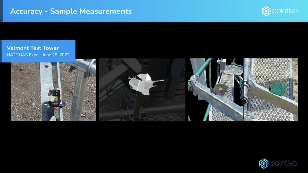
Pointivo delivers reports that require less than 30 minutes of review by a structural engineer, along with files for direct input to AutoCAD and Risa-3D, accelerating the analysis process for mounts and saving hours of time for engineers and their clients. Pointivo’s leading edge, AI-driven analytics platform automatically and precisely identifies all RAD equipment by manufacturer and model, mount geometry, and all mount member types and dimensions. Full access to the digital twin and the drone imagery is included with each report – for as long as you need it – enabling conditional inspection and views of the RAD center equipment from any angle.
No longer are firms required to wait weeks or even months to get a tower crew to climb and map a mount. Pointivo’s network of FAA licensed and experienced pilots are normally able to fly a tower within 2-3 days of notification/purchase order and cover all 50 states. Automated flight software delivers consistent data capture, and pilots are normally on site for less than 1 hour.
“The combination of speed, accuracy and seamless reporting is without peer in this industry, and no one else has demonstrated that they can deliver at the scale of Pointivo,” said Pat Lien, Vice President of Sales and Marketing. “We are processing more than 120 towers a day, every day, with the capacity to do ten times that.”

Pointivo’s Tower Analytics Platform is only one aspect of what the company delivers to the market, which also includes processing drone imagery and producing analytics for::
- Asset inspections
- Facility assessments
- Residential roofing and pre-solar installation inspections
- Energy sector inspections and more

Backed by AI-powered analytics, Pointivo is able to help industry-leading companies across different commercial industries simplify inspection and assessment processes and decisions related to physical assets.
Here is a video of the Mount Mapping done in record time of Valmont Tower at the NATE UAS Event.
Pointivo is an industry-leading provider that offers several solutions to accelerate workflows and scale your business. Leveraging digitization through drone captured data and AI-powered analytics is becoming increasingly relevant as organizations search for ways to supplement their teams and increase efficiency in telecom engineering, construction, and tower management. Reach out to us today to see how bolstering your team with drone automation will impact your business.
The Digitization of the Tower & Roofing Industry
Want to see how augmenting your resources with drone automation will impact your business?